Understanding River Flow Systems
Rivers are dynamic systems that transport water and sediment across the Earth's surface. How water moves both over land and within river channels is crucial to understanding river environments and their changes over time.
Key Definitions:
- Overland flow: The movement of water over the land surface before it enters a channel.
- Channel flow: The movement of water within a defined river channel.
- Discharge: The volume of water flowing through a river channel per unit of time (measured in cumecs - cubic metres per second).
- Velocity: The speed at which water flows (measured in metres per second).
💧 Overland Flow
Overland flow occurs when rainfall cannot infiltrate into the soil and instead moves across the land surface. This happens when:
- Rainfall intensity exceeds infiltration capacity
- The ground is already saturated
- The surface is impermeable (e.g., concrete, compacted soil)
- Vegetation cover is sparse or absent
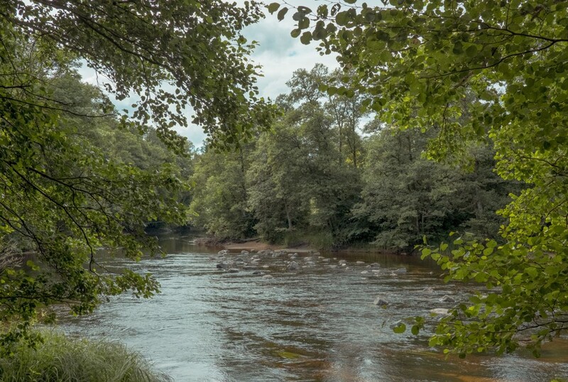
🌊 Channel Flow
Channel flow is the movement of water within the river channel itself. It is affected by:
- Channel shape and size (cross-section)
- Channel roughness (friction)
- Gradient (steepness) of the river
- Volume of water entering the channel
Factors Affecting Overland Flow
Several factors determine whether rainfall becomes overland flow or infiltrates into the ground:
🌧️ Rainfall Characteristics
Intensity: Heavy rainfall overwhelms infiltration capacity.
Duration: Prolonged rainfall saturates soil, increasing runoff.
Distribution: Where and when rain falls affects flow patterns.
🌱 Surface Conditions
Vegetation: Plants slow runoff and increase infiltration.
Soil type: Sandy soils absorb water faster than clay soils.
Slope: Steeper slopes increase runoff speed and volume.
🏙️ Human Factors
Urbanisation: Concrete surfaces prevent infiltration.
Deforestation: Removing trees increases runoff.
Land management: Farming practices affect water movement.
The Infiltration Process
Infiltration is the process by which water enters the soil surface. The rate at which this happens is crucial for determining how much rainfall becomes overland flow.
⬇️ Infiltration Capacity
This is the maximum rate at which water can enter the soil. It is affected by:
- Soil porosity and permeability
- Soil moisture content
- Presence of organic matter
- Soil compaction
When rainfall intensity exceeds infiltration capacity, overland flow occurs.
📊 Infiltration Rates
Different surfaces have vastly different infiltration rates:
- Forest floor: 10-15 mm/hour
- Grassland: 5-10 mm/hour
- Bare soil: 0-5 mm/hour
- Urban surfaces: 0-1 mm/hour
These rates explain why flooding is more common in urban areas.
Understanding Channel Flow
Once water enters a river channel, its movement is governed by different factors than overland flow. Channel flow is the primary way that water moves through a drainage basin.
Factors Affecting Channel Flow
The speed and volume of water in a channel depends on several key factors:
📏 Channel Geometry
Width and depth: Wider, deeper channels can carry more water.
Cross-sectional shape: Affects the wetted perimeter and hydraulic radius.
Sinuosity: Meandering channels slow flow compared to straight channels.
🧱 Channel Roughness
Bed material: Smooth bedrock creates less friction than boulders.
Vegetation: Plants in the channel increase roughness.
Obstacles: Debris and human structures affect flow patterns.
📉 Channel Gradient
Slope: Steeper channels have faster flow.
Profile changes: Gradient typically decreases downstream.
Local variations: Rapids, waterfalls and pools create flow diversity.
Velocity and Discharge
Two key measurements help us understand river flow: velocity and discharge.
🏃 Velocity
Velocity is the speed at which water flows, measured in metres per second (m/s).
Velocity varies:
- Across the channel (faster in the centre, slower at edges)
- Vertically (faster at surface, slower near bed)
- Along the course (generally increases downstream despite gradient decrease)
Typical velocities range from 0.1 m/s in small streams to over 3 m/s in large rivers during floods.
🌊 Discharge
Discharge is the volume of water passing a point in a given time, measured in cubic metres per second (cumecs).
Discharge formula: Q = A × V
Where:
- Q = Discharge (m³/s)
- A = Cross-sectional area (m²)
- V = Velocity (m/s)
Discharge typically increases downstream as tributaries join the main channel.
Human Impacts on River Flow
Human activities significantly alter both overland flow and channel flow patterns:
Urbanisation Effects
Urban development dramatically changes how water moves across landscapes:
- Increased impermeable surfaces reduce infiltration and increase overland flow
- Storm drains and sewers speed up the movement of water to channels
- Channel modifications (straightening, concrete lining) increase flow velocity
- Reduced lag time between rainfall and peak discharge
- Higher peak flows increasing flood risk
Case Study Focus: River Tees Flooding, UK
The River Tees in northeast England demonstrates how land use changes affect river flow:
- Urbanisation in Middlesbrough and Stockton has increased impermeable surfaces
- Agricultural practices in the upper catchment have compacted soils
- December 2015 flooding saw record discharge levels following Storm Desmond
- Peak discharge reached 900 cumecs (normal levels are around 20 cumecs)
- Flood management now includes both hard engineering (flood walls) and soft approaches (upstream woodland planting to slow runoff)
Flow Hydrographs
Hydrographs are graphs showing how river discharge changes over time, usually following a rainfall event.
📈 Natural Catchment Hydrograph
In natural, forested catchments:
- Longer lag time between peak rainfall and peak discharge
- Lower peak discharge
- More gradual rising and falling limbs
- Higher baseflow during dry periods
This pattern reduces flood risk and maintains river health.
📉 Urban Catchment Hydrograph
In urbanised catchments:
- Shorter lag time (sometimes just 1-2 hours)
- Higher peak discharge
- Steeper rising and falling limbs
- Lower baseflow during dry periods
This "flashy" response increases flood risk downstream.
Managing River Flow
Understanding overland and channel flow is essential for effective river management:
Sustainable Management Approaches
Modern river management focuses on working with natural processes:
- Afforestation: Planting trees in upland areas to increase interception and slow runoff
- Sustainable Urban Drainage Systems (SUDS): Permeable paving, rain gardens and detention basins to mimic natural drainage
- River restoration: Removing concrete channels and re-introducing meanders to slow flow
- Floodplain reconnection: Allowing rivers to access their natural floodplains during high flows
- Leaky dams: Small woody barriers in headwater streams that slow flow during floods but allow normal flow at other times
Case Study Focus: Pickering "Slowing the Flow" Project
Pickering in North Yorkshire has pioneered natural flood management:
- The town experienced severe flooding in 2007 with damages over £7 million
- Traditional flood defences were deemed too expensive
- Instead, 167 woody dams were installed in upstream tributaries
- 35,000 trees were planted in the catchment
- A small bund was created to temporarily store floodwater
- During the December 2015 floods, Pickering remained dry while nearby towns flooded
- The scheme cost £2 million, far less than traditional defences
This demonstrates how understanding and working with natural flow processes can create effective, sustainable solutions.