Introduction to River Deposition
Rivers don't just erode and transport material - they also drop or deposit it. Deposition happens when a river loses energy and can no longer carry its load. Understanding deposition helps us make sense of many river features and landscapes we see today.
Key Definitions:
- Deposition: The process where a river drops the material it's carrying when it loses energy.
- Load: The material carried by a river (bedload, suspended load, dissolved load).
- Competence: The maximum size of particle a river can carry.
- Capacity: The total amount of material a river can transport.
💧 When Does Deposition Happen?
Rivers deposit material when their energy decreases. This happens when:
- The river's velocity slows down
- The volume of water decreases
- The gradient (slope) becomes less steep
- The river enters a lake or the sea
- The river meets an obstruction
- After a flood when water levels fall
📐 Hjulström Curve
The Hjulström Curve shows the relationship between river velocity and the erosion, transportation and deposition of different sized particles.
Key points:
- Small particles like clay require high velocities to be eroded but can be transported at low velocities
- Larger particles like pebbles are deposited first when velocity drops
- The curve helps predict where different materials will be deposited
Major Depositional Landforms
As rivers deposit their load, they create distinctive landforms. These vary depending on where in the river course they form.
🗺 Upper Course
Alluvial Fans
Form where steep mountain streams suddenly enter flatter land. The sudden drop in gradient causes fan-shaped deposits of coarse material.
🗻 Middle Course
Point Bars & Floodplains
Point bars form on the inside of meander bends where velocity is lower. Floodplains develop from repeated flooding and deposition of fine sediment.
🌊 Lower Course
Deltas & Levees
Deltas form where rivers enter still water. Levees are raised banks formed during floods when coarser material is deposited close to the channel.
Floodplains and Levees
Floodplains are flat areas of land surrounding a river channel, formed by deposition during floods. They're some of the most important depositional features.
How Floodplains Form
When a river floods, it spills onto the surrounding land. As it does so, its velocity drops dramatically, causing it to deposit material. The heaviest material (sand and silt) is deposited first, near the channel, while finer particles (clay) are carried further away. Over time, repeated flooding builds up layers of sediment, creating a flat, fertile plain.
🚧 Natural Levees
Natural levees are raised ridges along riverbanks formed during floods. When a river overflows, the sudden drop in velocity causes coarser material to be deposited close to the channel. Over time, these deposits build up, creating natural embankments that can help contain smaller floods.
Levees are higher near the river and slope gently away, creating a distinctive profile.
🌿 Importance of Floodplains
Floodplains are incredibly valuable environments:
- They provide fertile agricultural land due to nutrient-rich deposits
- They act as natural flood storage areas, protecting places downstream
- They support diverse ecosystems and wetland habitats
- Many major settlements developed on floodplains for access to water and fertile soil
Meanders and Ox-bow Lakes
Meanders are winding bends in a river that develop naturally in the middle and lower course. They're sites of both erosion and deposition.
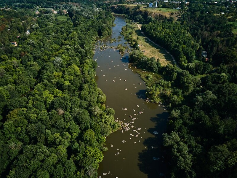
🗘 Point Bars
Point bars are deposits of sediment that form on the inside bend of a meander where water flows more slowly. They typically consist of coarser materials like sand and gravel. As the meander continues to develop, the point bar grows, pushing the channel further outward.
🏞 Ox-bow Lake Formation
Ox-bow lakes form when a meander is cut off from the main river channel:
- The neck of a meander narrows as erosion continues on the outside bends
- During a flood, the river may cut straight across the narrow neck
- Deposition seals off the old meander bend from the new straighter channel
- The cut-off meander becomes an ox-bow lake
Deltas: Where Rivers Meet the Sea
Deltas are complex depositional landforms that develop where rivers enter a body of standing water like the sea or a lake. They're named after the Greek letter delta (Δ) because of their triangular shape.
How Deltas Form
When a river meets the sea or a lake, several things happen:
- The river's velocity suddenly drops to near zero
- The river can no longer transport its load
- Material is deposited, starting with the coarsest
- Over time, these deposits build up, creating new land
📏 Arcuate Deltas
Fan-shaped deltas formed where river sediment is redistributed by waves and tides. The Nile Delta is a classic example.
📏 Bird's Foot Deltas
Long, finger-like channels extend into the sea where river processes dominate over marine ones. The Mississippi Delta is the most famous example.
📏 Cuspate Deltas
Tooth-shaped deltas that form where waves redistribute sediment equally on both sides of the river mouth. The Tiber Delta in Italy is an example.
Case Study Focus: The Ganges-Brahmaputra Delta
The Ganges-Brahmaputra Delta in Bangladesh is the largest delta in the world, covering over 105,000 km². It's formed where two major rivers - the Ganges and Brahmaputra - meet the Bay of Bengal.
Key features:
- Extremely fertile soil supports intensive agriculture (especially rice)
- Home to over 140 million people despite frequent flooding
- Contains the Sundarbans, the world's largest mangrove forest
- Highly vulnerable to sea level rise and climate change
- The delta continues to grow as approximately 1 billion tonnes of sediment is deposited annually
The delta demonstrates how depositional environments can be both beneficial (providing fertile land) and hazardous (flood risk) for human settlements.
Human Interactions with Depositional Environments
Depositional environments offer both opportunities and challenges for human societies.
👍 Benefits
- Agriculture: Deposited sediment creates some of the most fertile soils in the world
- Settlement: Flat land is easy to build on
- Resources: Sand and gravel deposits can be extracted for construction
- Tourism: Beaches formed by river deposits attract visitors
👎 Challenges
- Flooding: Depositional areas are often at risk of regular flooding
- Channel blockage: Excessive deposition can block navigation channels
- Changing landscapes: Depositional features can shift over time, affecting property boundaries
- Reduced reservoir capacity: Deposition in reservoirs reduces their storage capacity
Management of Depositional Processes
People manage depositional processes in various ways:
- Dredging: Removing deposited material to maintain channel capacity
- Artificial levees: Building embankments to prevent flooding
- Dams: Trapping sediment upstream (though this can cause problems downstream)
- Beach nourishment: Adding material to beaches to replace what's been eroded
- Land reclamation: Creating new usable land from depositional areas
Summary: The Importance of River Deposition
River deposition is a fundamental process that shapes our landscapes and creates environments that humans have relied on throughout history. From the fertile floodplains of ancient Egypt to modern delta cities like New Orleans, depositional landforms have been central to human settlement patterns.
Understanding deposition helps us:
- Predict how rivers will behave during floods
- Manage river systems more effectively
- Identify areas at risk from flooding
- Appreciate how landscapes evolve over time
- Recognise the interconnected nature of river processes
Remember that deposition is just one part of the river system - it works alongside erosion and transportation to create the dynamic river environments we see today.