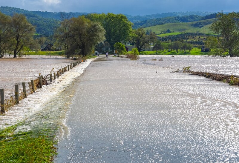
Understanding River Flooding
Rivers are dynamic systems that naturally flood from time to time. However, the frequency and severity of flooding can be influenced by both natural processes and human activities. Understanding these causes helps us predict, prepare for and manage flood events more effectively.
Key Definitions:
- Flooding: When a river overflows its banks and water spreads onto the floodplain.
- Discharge: The volume of water flowing through a river channel at a given point (measured in cumecs - cubic metres per second).
- Floodplain: The flat area of land adjacent to a river that experiences flooding.
- Hydrograph: A graph showing changes in river discharge over time.
- Flash flood: A sudden and rapid flooding of an area, typically occurring within 6 hours of heavy rainfall.
Natural Causes of River Flooding
Several natural factors can trigger or worsen river flooding. These are often related to weather patterns, landscape characteristics and the natural behaviour of river systems.
🌧 Heavy Rainfall
Intense or prolonged rainfall is the most common cause of river flooding. When rain falls faster than it can infiltrate the soil or be carried away by rivers, water levels rise rapidly. Seasonal rainfall patterns, storms and extreme weather events can all contribute to flooding.
❄ Snowmelt
Rapid melting of snow and ice, especially in spring, can release large volumes of water into river systems. When combined with rainfall, snowmelt can lead to significant flooding as rivers struggle to handle the increased discharge.
🌊 Coastal Flooding
In coastal areas, high tides and storm surges can block river mouths, preventing normal drainage and causing water to back up upstream. This is especially problematic during heavy rainfall events.
🌎 Watershed Characteristics
The shape, size and gradient of a drainage basin affect how quickly water reaches the river. Steep, impermeable catchments lead to faster runoff and higher flood risk. Basin shape can concentrate water, with circular basins often producing more intense flooding than elongated ones.
Physical Factors Influencing Flood Risk
The natural characteristics of a drainage basin play a crucial role in determining flood risk:
🔳 Soil Type
Clay soils have low permeability, causing more surface runoff. Sandy soils allow greater infiltration, reducing immediate flood risk.
🌳 Vegetation Cover
Forests and dense vegetation intercept rainfall, slow runoff and increase infiltration. Areas with little vegetation experience faster runoff and higher flood risk.
⛰ Topography
Steep slopes accelerate runoff, while flat areas may allow water to pond. Valley shape affects how quickly water concentrates in the main channel.
Human Causes of River Flooding
Human activities can significantly increase flood risk by altering natural drainage patterns, changing land use and modifying river channels.
🌇 Urbanisation
The expansion of urban areas creates impermeable surfaces (roads, pavements, buildings) that prevent infiltration and accelerate runoff. Drainage systems in cities can quickly channel water to rivers, causing rapid rises in discharge. A typical urban area may have 5 times more runoff than a forested area of the same size.
🌾 Deforestation
Removing trees and vegetation reduces interception and evapotranspiration. Without root systems to bind soil and absorb water, runoff increases and soil erosion worsens. Deforested areas can experience up to 20% more runoff compared to forested regions.
🔬 River Channel Modifications
Straightening rivers (channelization) increases flow velocity, moving flood problems downstream. Removing natural meanders reduces the river's capacity to store water. Building on floodplains restricts the natural space for rivers to overflow safely.
📅 Climate Change
Human-induced climate change is increasing the frequency and intensity of extreme weather events. Many regions are experiencing more intense rainfall events, altered seasonal patterns and more frequent storms, all of which contribute to increased flood risk.
Human Activities That Worsen Flooding
🚧 Infrastructure Development
Poorly designed bridges, culverts and dams can restrict river flow and create bottlenecks. Inadequate drainage systems in urban areas can be overwhelmed during heavy rainfall.
🏪 Floodplain Development
Building homes and businesses on floodplains reduces natural flood storage capacity and puts people and property at risk. In the UK, about 5.2 million properties are at risk of flooding.
🌳 Agricultural Practices
Intensive farming can compact soil, reducing infiltration. Removal of hedgerows and field boundaries accelerates runoff. Ploughing fields in the direction of the slope creates channels for water flow.
Case Study: Boscastle Flood, Cornwall, UK (2004)
On 16 August 2004, Boscastle experienced devastating flash floods after 200mm of rain fell in just 5 hours – equivalent to a month's rainfall. The small village is located at the confluence of three rivers in a steep-sided valley.
Natural causes:
- Intense convectional rainfall from summer thunderstorms
- Steep valley sides (gradient of 1 in 3)
- Impermeable slate bedrock limiting infiltration
- Convergence of three river channels in the village
- High tide preventing efficient drainage to the sea
Human factors:
- Narrow bridges and buildings restricting river flow
- Development on the floodplain
- Inadequate drainage systems
Impacts: Over 100 vehicles washed away, 58 buildings flooded, £50 million in damages, 150 people airlifted to safety. Remarkably, no lives were lost.
Analyzing Flood Risk
Understanding the combination of natural and human factors that contribute to flooding is essential for effective flood management. Hydrologists use various tools to assess flood risk:
📊 Hydrographs
Hydrographs show how river discharge changes over time in response to rainfall. Urban areas typically produce "flashy" hydrographs with steep rising limbs and high peak discharges, while rural areas with good vegetation cover produce more gentle hydrographs with lower peaks.
🗺 Flood Prediction Models
Computer models combine data on rainfall, topography, soil conditions and land use to predict flood risk. These models help authorities issue flood warnings and plan emergency responses. The UK Environment Agency uses such models to create flood risk maps and warning systems.
Flood Management Strategies
Understanding the causes of flooding helps us develop effective management strategies:
- Hard engineering: Building physical structures like dams, levees and flood walls to control water flow.
- Soft engineering: Working with natural processes through floodplain restoration, afforestation and sustainable drainage systems.
- Flood prediction and warning: Using technology to forecast floods and alert communities.
- Planning controls: Restricting development in high-risk areas and designing flood-resilient buildings.
Case Study: River Severn, UK
The River Severn is Britain's longest river and experiences regular flooding. In February 2020, Storm Dennis caused severe flooding along the Severn, affecting towns like Shrewsbury, Worcester and Gloucester.
Natural causes:
- Prolonged heavy rainfall from successive storms (Ciara and Dennis)
- Already saturated ground from previous wet weather
- Large catchment area (11,420 km²) collecting water from Welsh mountains
Human factors:
- Urban development on floodplains
- Agricultural practices in the catchment
- Climate change intensifying storm patterns
Management approaches: The Severn has a mix of hard engineering (flood barriers in Shrewsbury and Upton-upon-Severn) and soft engineering (washlands and natural flood management in tributaries). The Environment Agency operates a sophisticated flood warning system for communities along the river.
Summary: The Interplay of Natural and Human Factors
River flooding results from a complex interaction of natural and human factors. While we cannot prevent natural processes like heavy rainfall or snowmelt, we can modify human activities to reduce flood risk. Sustainable land management, careful urban planning and river restoration can all help communities become more resilient to flooding.
As climate change continues to alter weather patterns, understanding and addressing both the natural and human causes of flooding becomes increasingly important for protecting lives, property and infrastructure.