Changing River Environments » Case Study: The York Floods, December 2015
What you'll learn this session
Study time: 20 minutes
- Where York is and why it floods
- The causes of the December 2015 floods
- The social, economic and environmental impacts
- How the flooding was managed in the short, medium and long term
- How to evaluate the York flood management strategy
🔒 Unlock Full Course Content
Sign up to access the complete lesson and track your progress!
Unlock This CourseCase Study: The York Floods, December 2015
Your exam needs one detailed flood example with named places, dates and figures. York in December 2015 is a strong choice because it has clear causes, impacts and management you can evaluate. This lesson is the worked example for the ideas you met in Human and Natural Causes of River Flooding, Impacts of River Flooding and Managing River Flooding: Hard, Soft and Sustainable Strategies.
📍 Location and Background
York is a historic city in North Yorkshire, England, situated at the confluence of the Rivers Ouse and Foss. The city has a long history of flooding, with the River Ouse having flooded over 40 times since records began in 1263.
🌧️ Causes
The December 2015 floods were triggered by Storm Eva, which brought exceptionally heavy rainfall to northern England. The storm followed an already wet autumn, meaning the ground was saturated. Key factors included:
- Record-breaking rainfall (215mm in 24 hours in some areas)
- Saturated catchment from previous rainfall
- Urban development reducing water storage capacity
- Failure of the Foss Barrier flood defence system
💧 Scale and Impacts
The River Ouse peaked at 5.2 metres above normal levels, the second-highest level ever recorded. Impacts included:
- Social: Over 600 homes and 130 businesses flooded; 4,000 properties lost power; hundreds evacuated on Christmas Day
- Economic: £500 million in damages; tourism affected; many businesses closed for months
- Environmental: Sewage contamination of floodwaters; debris spread across floodplain; erosion of riverbanks
🛡️ Response and Management
Following the floods, several measures were implemented:
- Short-term: Emergency evacuation; temporary accommodation; military assistance; distribution of sandbags
- Medium-term: The Foss Barrier was upgraded with new, more powerful pumps and its controls moved above flood level; repairs to damaged flood defences
- Long-term: £45 million government-funded "York Five Year Flood Plan" (Environment Agency, 2016) to better protect around 2,000 properties, including new flood walls, embankments and pumping stations; natural flood management in the wider catchment, such as tree planting, leaky dams and areas where water can be stored upstream so less reaches the city at once; improved flood warning systems and local flood groups
📊 Evaluation
The York flood management strategy now combines both hard and soft engineering approaches, the mix of structures and natural flood management described in Managing River Flooding: Hard, Soft and Sustainable Strategies:
- Successes: Improved flood defences have protected the city from subsequent high water events; better warning systems; increased community preparedness; managing the whole catchment, not just the city, and involving local people
- Challenges: Climate change likely to increase flood risk; continued pressure for development on flood-prone land; high costs of maintaining defences
How sustainable is it? The walls, barrier and pumps protect the city now, but they are expensive to maintain and will need raising as flood levels rise. Natural flood management upstream and better warnings are cheaper, work with the river and help people live with flood risk. Using both makes York's approach more sustainable than defences alone.
The Wider Picture: Winter 2015-16
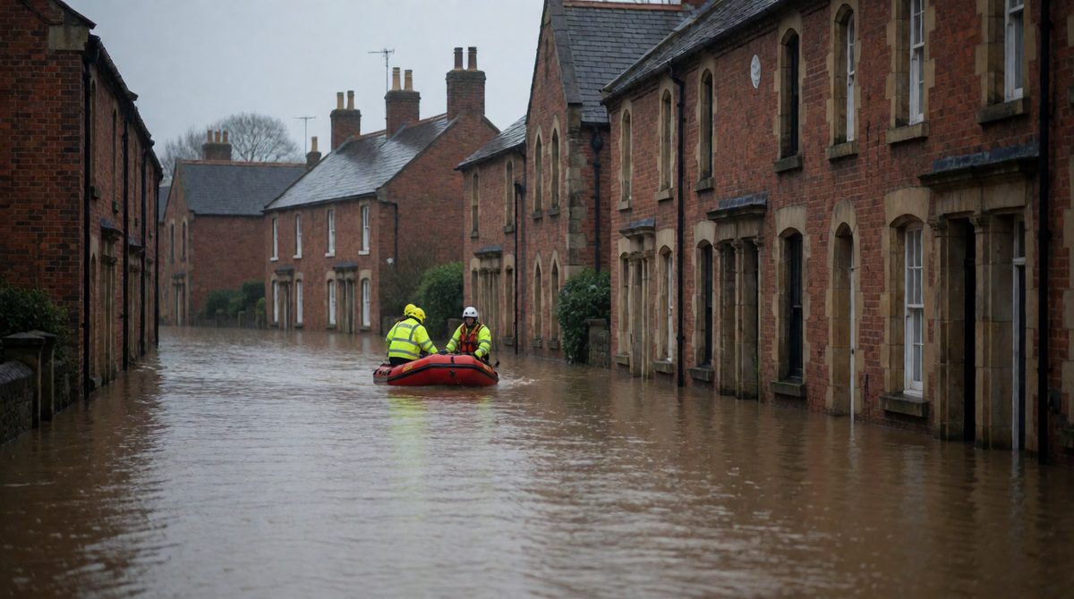
Floodwater like this swamped streets in Cumbria, Lancashire and Yorkshire during Storms Desmond, Eva and Frank in winter 2015-16
York was one part of a much bigger event. During winter 2015-16 the UK was hit by Storms Desmond, Eva and Frank in quick succession.
Case Study Context: UK Floods 2015-16
- Economic damage estimated at £1.6 billion
- 16,000 properties flooded in Cumbria, Lancashire and Yorkshire
- Major infrastructure damage, including the collapse of Tadcaster Bridge
- Electricity supplies cut to 43,000 homes
- Tourism industry severely affected
- Only 5 deaths directly attributed to the floods
This shows how a HIC can suffer huge economic damage but relatively low loss of life, thanks to warning systems and emergency response.
✅ Exam Tip: Case Study Knowledge
For your IGCSE Geography exam, you should be able to:
- Name a specific river and flood event (location, date)
- Explain both physical and human causes of the flooding
- Describe specific social, economic and environmental impacts
- Outline at least three management strategies used
- Evaluate the effectiveness of the management approaches
Use specific facts, figures and place names to demonstrate detailed knowledge!