Understanding River Systems
Rivers are dynamic systems that shape our landscape and provide vital resources for humans and wildlife. They begin as small streams high up in hills or mountains and grow larger as they flow downhill, eventually reaching the sea or a lake. Along their journey, rivers create distinctive features that geographers study to understand how water shapes our planet.
Key Definitions:
- Source: The starting point of a river, typically in upland areas.
- Tributary: A smaller river or stream that flows into a larger river.
- Confluence: The point where two or more rivers or streams join together.
- Mouth: The place where a river flows into the sea, a lake, or another river.
💧 The River Journey
Rivers follow a journey from their source to their mouth, changing in character as they go. In the upper course, rivers are typically fast-flowing with steep gradients. In the middle course, they widen and slow down. By the lower course, rivers are at their widest and slowest, often forming features like meanders and floodplains before reaching their mouth.
🌍 River Systems Worldwide
River systems vary enormously across the globe. Some, like the Amazon, have thousands of tributaries creating vast drainage basins. Others, like those in desert regions, may flow only seasonally. The world's longest river system is the Nile-Kagera, stretching 6,695 km across northeastern Africa.
The Source of a River
Every river begins somewhere – this starting point is called the source. River sources come in several forms and are typically found in upland areas where precipitation is higher.
Types of River Sources
Rivers can begin in various ways, depending on the local geography and climate:
☃ Glacial Melt
Many rivers begin as meltwater from glaciers or snowfields. The River Thames, for example, originally had its source from springs fed by rainwater and snowmelt in the Cotswold Hills.
🌊 Springs
Underground water can emerge at the surface as springs when the water table meets the ground surface. The River Severn in the UK begins as a small spring on Plynlimon in Wales.
🌩 Marshes and Lakes
Some rivers flow out of marshes, bogs, or lakes. The River Nile's most distant source is believed to be streams that feed Lake Victoria in central Africa.
At the source, rivers are typically small, shallow and fast-flowing. They often have clear, cold water and rocky beds. The land around the source is usually steep, causing the water to flow rapidly downhill, eroding the landscape as it goes.
Case Study Focus: The Source of the Amazon
The Amazon River's most distant source was only officially identified in 2014 as the Mantaro River in Peru. Scientists used GPS tracking to determine that this tributary extends the Amazon's length to approximately 6,800 km. The source is located high in the Andes Mountains, where melting snow and ice form small streams that eventually become the world's largest river by volume. The water at the source travels nearly 4,000 miles before reaching the Atlantic Ocean.
Tributaries: Building the River Network
As a river flows downhill, it's joined by smaller rivers and streams called tributaries. These add water, sediment and nutrients to the main river, increasing its size and power.
How Tributaries Shape River Systems
Tributaries are crucial to understanding how river systems develop and function:
- Drainage patterns: The way tributaries join the main river creates distinctive drainage patterns that reflect the underlying geology and topography.
- Water volume: Each tributary increases the main river's discharge (volume of water flowing past a point in a given time).
- Sediment load: Tributaries bring sediment from different areas, affecting the main river's appearance and behaviour.
- Flood risk: Heavy rainfall in tributary catchments can cause flooding downstream in the main river.
📏 Drainage Patterns
Tributaries form different patterns depending on the landscape. A dendritic pattern (tree-like) forms on uniform rocks. A trellis pattern forms where hard and soft rocks alternate. A radial pattern forms around dome-shaped features like volcanoes, with tributaries flowing outward in all directions.
💦 Discharge Changes
Each tributary increases the main river's discharge. For example, the River Mississippi receives water from major tributaries like the Missouri and Ohio Rivers, which together drain about 41% of the continental United States. This makes the Mississippi the fourth largest river in the world by discharge.
Confluences: Rivers Meeting
A confluence is where two or more rivers or streams join together. These meeting points are fascinating geographical features that can dramatically change a river's character.
What Happens at a Confluence?
When rivers meet, several important processes occur:
- Increased water volume: The combined flow is greater than either individual river.
- Mixing of sediments: Different coloured waters can sometimes be seen mixing for several kilometres downstream.
- Changed flow dynamics: The speed and direction of water flow often changes at confluences.
- Deposition: Sediment often builds up at confluences, sometimes forming islands.
Case Study Focus: The Meeting of Waters (Encontro das Águas)
One of the most spectacular confluences in the world is in Brazil, where the dark Rio Negro meets the sandy-coloured Amazon River (Solimões). The two rivers flow side by side for about 6 km without mixing due to differences in temperature, speed and water density. The Rio Negro is warmer (28°C), slower and less dense, while the Amazon is cooler (22°C), faster and carries more sediment. This creates a striking visual boundary where the two distinct waters flow alongside each other before eventually mixing.
Confluences have historically been important sites for human settlement. Many major cities are located at confluences, including Khartoum (Blue and White Nile), Pittsburgh (Allegheny and Monongahela Rivers) and Lyon (Rhône and Saône Rivers). These locations offered advantages for trade, transport and defence.
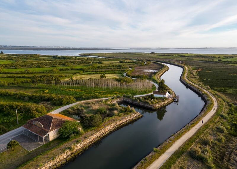
The River Mouth: Journey's End
After potentially travelling hundreds or thousands of kilometres, a river reaches its mouth – the point where it flows into the sea, a lake, or sometimes another river. The mouth is where the river deposits much of its sediment load, creating distinctive landforms.
Types of River Mouths
River mouths come in different forms, depending on the balance between river processes and marine processes:
🌊 Estuaries
An estuary forms when the sea floods a river valley, creating a mixture of fresh and salt water. The Thames Estuary is a classic example, with its wide, funnel-shaped mouth. Estuaries are influenced by tides and often contain mudflats that are exposed at low tide. They're incredibly productive ecosystems, supporting diverse wildlife.
🏜 Deltas
Deltas form where rivers deposit sediment faster than the sea can remove it. The Nile Delta in Egypt is a famous example, with its triangular shape resembling the Greek letter delta (Δ). Deltas are typically flat, fertile areas with multiple river channels called distributaries. They're valuable for agriculture but vulnerable to sea-level rise.
At the mouth, rivers are typically at their widest and deepest. The water moves slowly and contains a high sediment load. The land is flat and the river may split into multiple channels. Tidal influences can push saltwater upstream, creating brackish water conditions that support unique ecosystems.
Human Impacts on River Features
People have modified river systems for thousands of years, changing their natural features and processes:
- Dams and reservoirs: These can create artificial lakes near river sources and regulate flow downstream.
- Channelisation: Straightening and deepening rivers affects their natural flow patterns.
- Pollution: Industrial and agricultural pollution changes water quality throughout river systems.
- Extraction: Removing water for irrigation or drinking can reduce river discharge.
- Climate change: Changing rainfall patterns affect river sources and flow regimes.
🚧 Case Example: Three Gorges Dam
The Three Gorges Dam on the Yangtze River in China has created a 600km-long reservoir that has submerged numerous tributaries and confluences. It controls the flow of the river, reducing seasonal variations and changing sedimentation patterns all the way to the river's mouth in the East China Sea.
🌱 Sustainable River Management
Modern approaches to river management increasingly work with natural processes rather than against them. This includes restoring meanders, creating wetlands to store floodwater and removing obsolete dams to restore natural flow. The "Room for the River" programme in the Netherlands is an example, giving rivers more space to flood safely.
Studying River Features
When studying rivers for your iGCSE, you should be able to identify key features on maps and in photographs. Look for:
- Contour lines close together (steep gradient) near sources
- Blue lines joining (confluences)
- The pattern of tributaries (drainage pattern)
- Wide, flat areas near river mouths
- Multiple channels at deltas
- Evidence of human modifications like dams or straightened sections
Remember that rivers are dynamic systems that change over time. The features we see today are the result of ongoing processes of erosion, transportation and deposition that have shaped the landscape over thousands of years – and will continue to do so in the future.