Understanding Drainage Basins
A drainage basin is like a giant natural bowl that collects water from rainfall and directs it towards a main river channel. Every stream and river you see is part of a drainage basin system that shapes our landscapes and provides vital water resources.
Key Definitions:
- Drainage Basin: An area of land drained by a river and its tributaries.
- Watershed/Divide: The boundary between drainage basins, usually along ridges or high ground.
- Tributary: A smaller stream or river that flows into a larger river.
- Confluence: The point where two rivers meet.
- Source: The starting point of a river.
- Mouth: Where a river enters the sea, a lake, or another river.
🌎 Drainage Basin Structure
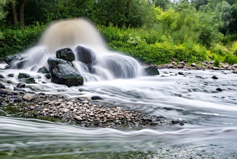
A drainage basin works like a funnel system. Rain that falls within the watershed flows downhill, collecting in streams that join to form larger rivers. The shape of the land determines how quickly water moves through the system and where it collects.
Think of it as a tree-like pattern: small streams (like twigs) join to form larger tributaries (branches), which eventually connect to the main river (trunk).
💧 Drainage Patterns
Rivers form different patterns depending on the underlying geology and landscape:
- Dendritic: Tree-like pattern on uniform rocks
- Radial: Rivers flowing outward from a central high point
- Trellis: Parallel main rivers with tributaries joining at right angles
- Rectangular: Rivers with sharp bends following rock fractures
The Water Cycle in Drainage Basins
The water cycle (or hydrological cycle) is the continuous movement of water between the atmosphere, land and oceans. In a drainage basin, this cycle determines how much water is available in rivers and how it moves through the landscape.
☔ Precipitation
Water falls as rain, snow, sleet or hail. The amount and intensity affect how water moves through the drainage basin.
☁ Evaporation & Transpiration
Water returns to the atmosphere from surface water (evaporation) and through plants (transpiration). Together they're called evapotranspiration.
💦 Condensation
Water vapour cools and forms clouds, eventually leading to precipitation and continuing the cycle.
Water Movement in Drainage Basins
When rain falls on a drainage basin, it can take several different pathways to reach the river channel. Understanding these pathways helps explain why some rivers flood quickly while others respond more slowly to rainfall.
🚰 Surface Pathways
- Surface Runoff: Water flowing over the ground surface when soil is saturated or rainfall intensity exceeds infiltration capacity.
- Channel Flow: Water moving through river channels.
- Overland Flow: Sheet-like flow of water over the land surface before it concentrates into channels.
🛏 Subsurface Pathways
- Infiltration: Water soaking into the soil.
- Throughflow: Water moving laterally through the soil towards streams.
- Percolation: Downward movement of water through soil to groundwater.
- Groundwater Flow: Slow movement of water through rocks beneath the water table.
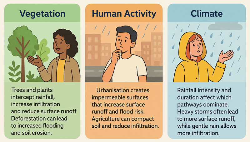
Factors Affecting Water Movement
Several factors influence how water moves through a drainage basin:
🌱 Vegetation
Trees and plants intercept rainfall, increase infiltration and reduce surface runoff. Deforestation can lead to increased flooding and soil erosion.
🏠 Human Activity
Urbanisation creates impermeable surfaces that increase surface runoff and flood risk. Agriculture can compact soil and reduce infiltration.
🌑 Climate
Rainfall intensity and duration affect which pathways dominate. Heavy storms often lead to more surface runoff, while gentle rain allows more infiltration.
River Discharge and Hydrographs
River discharge is the volume of water flowing through a river channel at a specific point, measured in cumecs (cubic metres per second). Hydrographs show how discharge changes over time, especially after rainfall events.
Storm Hydrographs
A storm hydrograph shows how a river responds to a rainfall event. Key features include:
- Rising Limb: Shows discharge increasing after rainfall
- Peak Discharge: Maximum flow rate
- Lag Time: Time between peak rainfall and peak discharge
- Falling/Recession Limb: Shows discharge decreasing after the peak
- Base Flow: Normal river flow from groundwater sources
Steep rising limbs and short lag times indicate rapid response to rainfall, often in urban areas or steep drainage basins. Gentle slopes and longer lag times suggest slower responses, typical in forested or permeable catchments.
Case Study Focus: The River Severn Drainage Basin, UK
The River Severn is Britain's longest river (354km) with a drainage basin covering about 11,000 km². It demonstrates many key drainage basin features:
- The upper basin in the Welsh mountains has steep slopes, thin soils and high rainfall, leading to rapid runoff and flashy discharge patterns.
- The middle and lower basin crosses flatter land with more permeable rocks, resulting in slower responses to rainfall.
- Human impacts include urbanisation (Birmingham, Gloucester), agricultural land use and flood management schemes.
- The Severn has experienced severe flooding, notably in 2007 and 2020, prompting extensive flood management strategies including the Severn Valley Flood Management Plan.
Human Impacts on Drainage Basins
Human activities can significantly alter how drainage basins function, often with unintended consequences:
🌇 Urbanisation Effects
Urban development increases impermeable surfaces (roads, buildings, car parks), reducing infiltration and increasing surface runoff. This leads to:
- Faster flow of water to river channels
- Higher peak discharges
- Shorter lag times
- Increased flood risk
- Reduced groundwater recharge
🌾 Agricultural Impacts
Modern farming practices can affect drainage basin hydrology through:
- Soil compaction from heavy machinery
- Removal of hedgerows and field boundaries
- Land drainage systems
- Deforestation for farmland
- Creation of artificial channels
These changes often accelerate water movement through the basin.
Sustainable Drainage Basin Management
Managing drainage basins sustainably involves working with natural processes rather than against them:
- Afforestation: Planting trees to intercept rainfall, increase infiltration and slow runoff
- Sustainable Urban Drainage Systems (SUDS): Using permeable pavements, green roofs and retention ponds to mimic natural drainage
- River restoration: Returning channelised rivers to more natural, meandering courses
- Wetland creation: Developing areas that can temporarily store floodwater
- Integrated catchment management: Coordinating land and water management across entire drainage basins
Case Study: Pickering "Slowing the Flow" Project, North Yorkshire
After severe flooding in 2007, this market town implemented natural flood management techniques across its drainage basin:
- 300+ small wooden dams in woodland streams to slow water flow
- Planting 40,000+ trees to increase interception and infiltration
- Creating storage bunds (earth banks) to temporarily hold floodwater
- Restoring heather moorland to slow runoff from upland areas
Results: During heavy rainfall in December 2015, the scheme prevented flooding that would have affected 40+ homes and businesses. The project demonstrates how working with natural processes can effectively manage flood risk while providing additional benefits for wildlife and carbon storage.
Key Points to Remember
- Drainage basins are dynamic systems where water follows various pathways from precipitation to river channels
- The water cycle operates continuously, with water moving between atmosphere, land and rivers
- Physical factors (geology, relief, soil type) and human activities affect how water moves through drainage basins
- Storm hydrographs reveal how quickly rivers respond to rainfall events
- Sustainable management approaches work with natural processes to reduce flood risk and protect water resources