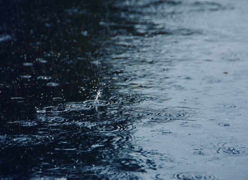
Understanding Precipitation
Precipitation is a vital part of the water cycle and plays a crucial role in shaping river environments. It's the main source of water for rivers and directly impacts their flow, characteristics and surrounding ecosystems.
Key Definitions:
- Precipitation: Any form of water that falls from clouds and reaches the Earth's surface, including rain, snow, sleet and hail.
- Water cycle: The continuous movement of water between the Earth's surface, atmosphere and underground.
- Intensity: The rate at which precipitation falls, usually measured in mm per hour.
- Duration: How long a precipitation event lasts.
🌧 Types of Precipitation
Rain: Liquid water drops that fall when water vapour condenses in the atmosphere.
Snow: Ice crystals formed when water vapour freezes in the atmosphere.
Sleet: A mixture of rain and snow, or partially melted snow.
Hail: Balls or lumps of ice that form in thunderstorm clouds when water droplets freeze in layers.
💧 Measuring Precipitation
Rain gauge: A simple instrument that collects and measures rainfall.
Weather radar: Uses radio waves to detect precipitation in the atmosphere.
Satellite imagery: Provides large-scale views of precipitation patterns.
Units: Usually measured in millimetres (mm) or inches.
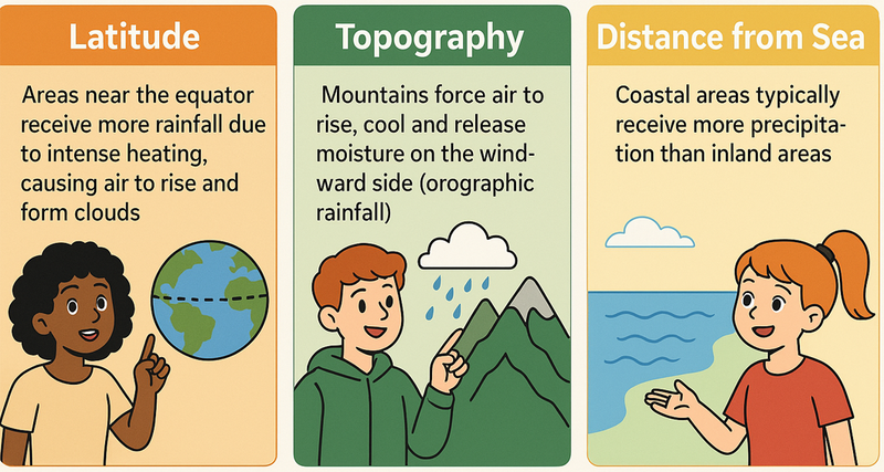
Factors Affecting Precipitation Patterns
Precipitation isn't evenly distributed across the Earth. Several factors influence where, when and how much precipitation falls:
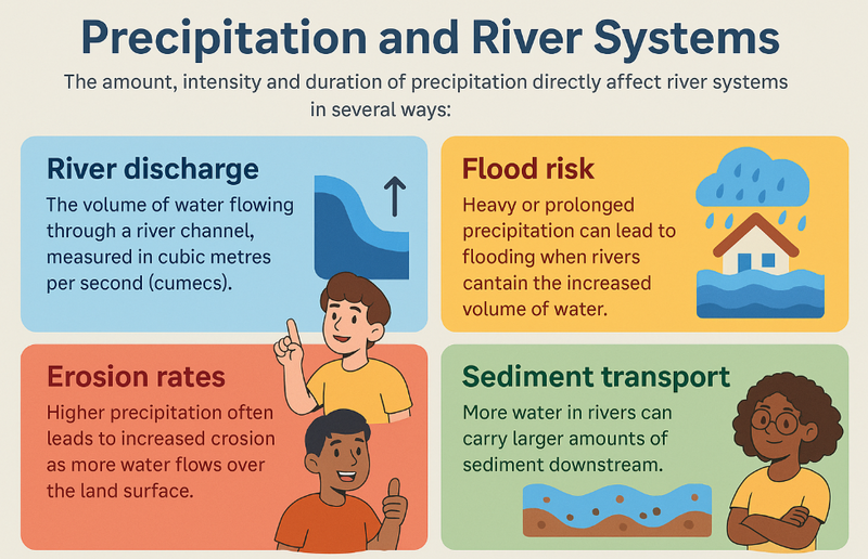
Precipitation and River Systems
The amount, intensity and duration of precipitation directly affect river systems in several ways:
- River discharge: The volume of water flowing through a river channel, measured in cubic metres per second (cumecs).
- Flood risk: Heavy or prolonged precipitation can lead to flooding when rivers cannot contain the increased volume of water.
- Erosion rates: Higher precipitation often leads to increased erosion as more water flows over the land surface.
- Sediment transport: More water in rivers can carry larger amounts of sediment downstream.
Case Study Focus: UK Precipitation Patterns
The UK shows clear regional differences in precipitation. Western areas, particularly Wales, northwest England and western Scotland, receive significantly more rainfall (over 3,000mm annually in some upland areas) than eastern regions (less than 700mm in parts of East Anglia). This is due to prevailing westerly winds bringing moisture from the Atlantic Ocean, which falls as orographic rainfall when air rises over western hills and mountains.
These precipitation patterns directly influence the UK's river systems, with western catchments typically having higher discharge and flashier regimes than eastern rivers.
Understanding Interception
Before precipitation reaches the ground and enters river systems, it may be intercepted by vegetation and other surfaces. This process, known as interception, plays a crucial role in the water cycle and river environments.
Key Definitions:
- Interception: The process where precipitation is caught by vegetation or structures before it reaches the ground.
- Throughfall: Water that passes through gaps in vegetation canopy.
- Stemflow: Water that runs down stems and trunks to reach the ground.
- Canopy storage: Water temporarily held on leaves and branches.
🌲 The Interception Process
When rain falls on vegetation:
1. Some is caught and held by leaves and branches (interception storage)
2. Some drips through gaps in the canopy (throughfall)
3. Some runs down stems and trunks (stemflow)
4. Intercepted water may evaporate back to the atmosphere
📖 Importance of Interception
Reduces runoff: Less water reaches the ground immediately
Delays water entry: Slows the movement of water into river systems
Reduces flood risk: Helps prevent sudden surges in river discharge
Increases evaporation: Returns water to the atmosphere
Factors Affecting Interception Rates
The amount of precipitation intercepted varies widely depending on several factors:
🌳 Vegetation Type
Different types of vegetation intercept varying amounts of precipitation:
- Coniferous forests: 25-45% interception
- Deciduous forests: 10-25% interception
- Grasslands: 5-15% interception
- Crops: Varies by type and growth stage
🌦 Precipitation Characteristics
- Light rain: Higher percentage intercepted
- Heavy rain: Lower percentage intercepted as canopy becomes saturated
- Duration: Longer events lead to lower overall interception rates
- Type: Snow may be intercepted differently than rain
🌱 Seasonal Factors
- Deciduous trees intercept more in summer when in leaf
- Winter interception rates are lower in deciduous forests
- Coniferous forests maintain relatively consistent interception year-round
- Crop interception varies with growth stage
Human Impacts on Interception and River Environments
Human activities significantly affect interception processes and, consequently, river environments:
- Deforestation: Reduces interception, increases runoff and can lead to more frequent and severe flooding.
- Urbanisation: Replaces vegetation with impermeable surfaces, drastically reducing interception and increasing surface runoff.
- Agriculture: Different crop types and farming practices affect interception rates differently.
- Afforestation: Planting trees increases interception and can help manage flood risk in river catchments.
Case Study Focus: Pickering, North Yorkshire
Pickering has historically suffered from flooding, with major events in 1999, 2000, 2002 and 2007. Instead of traditional flood defences, a natural flood management approach was implemented, including:
- Planting 29 hectares of woodland upstream to increase interception
- Creating 167 small dams made of logs and branches to slow water flow
- Building a small bund to store floodwater temporarily
This "Slowing the Flow" project has successfully reduced flood risk by increasing interception and slowing water movement through the catchment. During heavy rainfall in December 2015, when nearby areas flooded, Pickering remained dry, demonstrating the effectiveness of using natural processes like interception to manage river environments.
Interception and River Hydrographs
Interception has a measurable impact on river discharge patterns, which can be seen in river hydrographs:
- Lag time: Areas with high interception typically have longer lag times between peak rainfall and peak discharge.
- Peak discharge: Higher interception rates generally result in lower peak discharge values.
- Rising limb: The rising limb of the hydrograph is usually less steep in catchments with good vegetation cover.
- Recession limb: The falling limb may be more gradual as water continues to reach the channel slowly.
Understanding the relationship between precipitation, interception and river systems is crucial for managing river environments sustainably and reducing flood risks in a changing climate.