✎ Drawing a sketch map
Draw a simple outline. Add only the main features, such as roads, rivers, buildings and woods. Add a title. Add a north arrow. Use a simple key if you use shading or symbols.
Sign up to access the complete lesson and track your progress!
Unlock This Course
Field sketches help you notice and label key features
A map shows a place from above, using symbols. A photograph shows what a place really looks like. The exam often gives you both, so you need to use them together. A map can tell you where a photograph was taken. A photograph can show you what the symbols on the map look like in real life.
Key terms:
You may be given two maps of the same place. One may be an older map and one a newer map. Or they may be at different scales. To compare them, look for what is the same and what is different.
A good answer uses both maps: "On the older map the area north of the river is fields. On the newer map it is covered with buildings, so the town has grown."
A sketch map is quick to draw and only needs the important details. You may be asked to draw one, to label one, or to interpret one that is already drawn.
Draw a simple outline. Add only the main features, such as roads, rivers, buildings and woods. Add a title. Add a north arrow. Use a simple key if you use shading or symbols.
Read the title and key first. Then say what the map shows, using the features drawn. For example, "The main road runs along the river valley, so most of the buildings are next to it."
A sketch map does not need to be a work of art. It must be clear, and the labels must be easy to read.
Shows detail you can see from the ground, such as the shape of a cliff, the type of rock or the plants. It shows a smaller area than an aerial or satellite image, and you cannot see the layout from above.
Taken from the air. A vertical aerial photograph looks straight down, like a map. An oblique aerial photograph looks down at an angle, so you can see height and shape.
Taken from space. It shows very large areas, such as a whole coastline or city. Fine detail is harder to see.
Choose the right type for the job. To see how large a flood is, use a satellite image. To see the type of rock in a cliff, use a ground photograph.
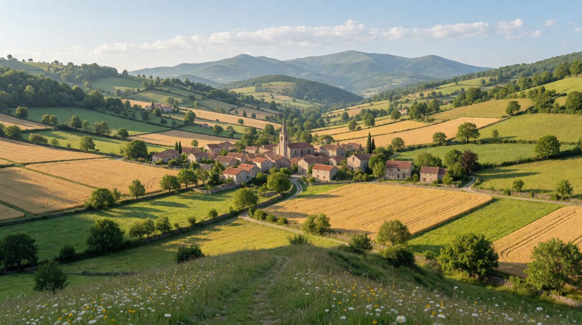
Describe a photo by its foreground, middle ground and background
The spec asks you to describe human and physical landscapes from photographs. That means you should be able to describe these things:
You should also describe geographical phenomena, such as a landslide, a flood or a coastline being eroded.
It helps to split a photograph into three parts: the foreground (closest to you), the middle ground and the background (furthest away). Then describe each part in turn.
A sketch from a photograph picks out the important features only. Follow these steps:
You may be asked to label or annotate diagrams, maps, graphs, sketches and photographs. They are not the same thing.
Keep notes short. Draw a line from the note to the exact feature. Do not draw lines that cross. On a graph, you can annotate a peak, a sudden fall or an unusual result. On a map, you can annotate a pattern, such as a cluster of buildings beside a river.
A photograph shows a river in a wide, flat valley. Houses are in the foreground. Fields are in the middle ground. Hills with trees are in the background.
Description: "In the foreground there are houses, so the land is used for housing and is part of a settlement. In the middle ground there are fields, so the land is used for farming. In the background there are wooded hills, which is natural vegetation on higher, steeper land."
Drawing a sketch with too much detail, so it is messy. Writing a label when the question asks for an annotation. Describing what is not in the photograph. Not saying where in the photograph the feature is, such as foreground or background.
A photograph shows a coastal town. There is a sandy beach in the foreground, houses behind the beach and cliffs with grass in the background.
(a) Name the type of image taken from space that would show the whole coastline of a large area. [1 mark]
(b) Describe the land-use shown in the photograph. [2 marks]
(c) Explain the difference between a label and an annotation. [2 marks]
(a) A satellite image (1).
(b) The land behind the beach is used for housing, which is part of a settlement (1). The sandy beach in the foreground is used for recreation or tourism (1).
(c) A label names a feature (1). An annotation adds an explanation or description of the feature (1).
In part (b), use the words foreground and background to say where each land-use is, so each mark point is clear.